
Click Image to Download (38 MB PDF)
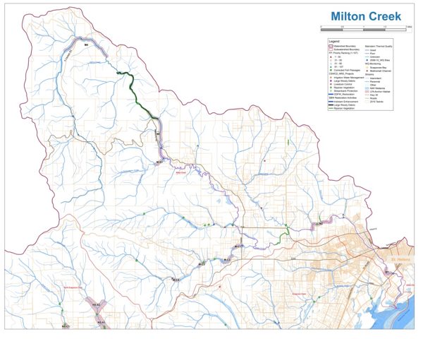
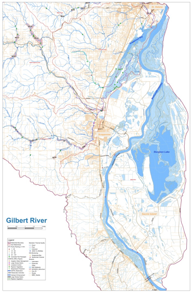
The Scappoose Bay Watershed is unique by its location at the end of the Willamette River via the Multnomah Channel, and its convergence with the Lower Columbia River. Encompassing both steep, forested environs and lowland floodways, it has significant salmonid habitat and native wildlife potential. Past practices and development pressures have cut off historical side channels, reduced stream quality, and brought invasive species to once diverse vegetation stands. This plan is designed to improve the health of the watershed through specific, prioritized restoration actions.
Scappoose Bay Watershed:
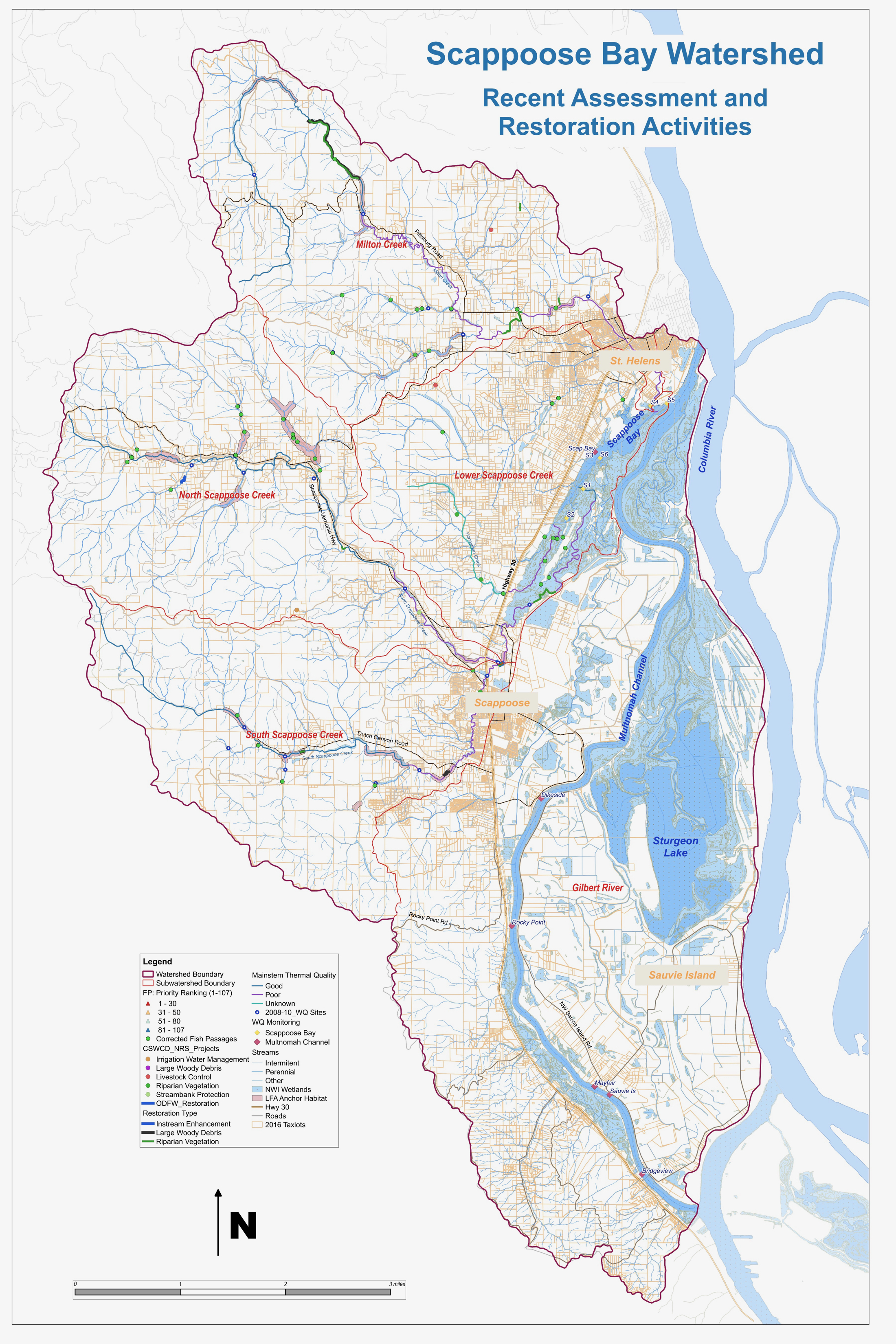
Scappoose Bay Watershed Map (6 MB JPG)
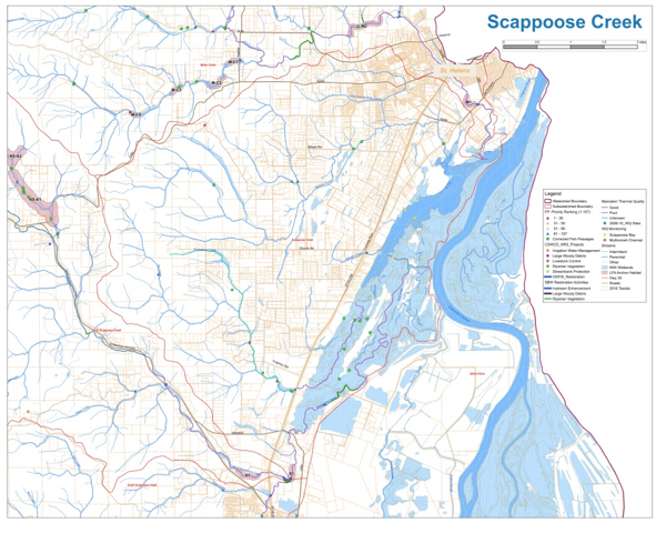
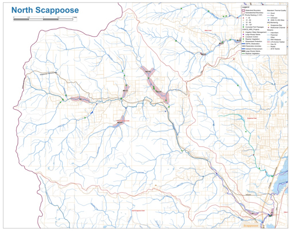
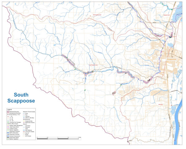
The five (5) Sub-Watersheds are: